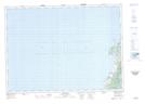
Maps showing Cap Le Moine, Inverness, Nova Scotia
Cap Le Moine is a Unincorporated area located in Inverness, Nova Scotia and has an elevation of 41 meters.
- Latitude: 46° 30' 46'' North (decimal: 46.5127777)
- Longitude: 61° 4' 9'' West (decimal: -61.0691666)
- Topography Feature Category: Unincorporated area
- Geographical Feature: Community
- Canadian Province/Territory: Nova Scotia
- Elevation: 41 meters
- Location: Inverness
- Atlas of Canada Locator Map: Cap Le Moine
- GPS Coordinate Locator Map: Cap Le Moine Lat/Long