Canada Topographic Maps

Caribou River Topo Maps

Topography maps and Latitude/Longitude Location

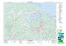
Maps showing Caribou River, Nova Scotia

Caribou River is a River located in Nova Scotia.

  • Latitude: 45° 45' North   (decimal: 45.7499999)
  • Longitude: 62° 46' West   (decimal: -62.7658333)
  • Topography Feature Category: River
  • Geographical Feature: River
  • Canadian Province/Territory: Nova Scotia
  • GPS Coordinate Locator Map: Caribou River Lat/Long

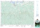
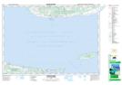
Caribou River NTS Map Sheets

011E10 New Glasgow Topographic Map at 1:50,000 scale

011E11 Tatamagouche Topographic Map at 1:50,000 scale

011E15 Pictou Island Topographic Map at 1:50,000 scale

011E Truro Topographic Map at 1:250,000 scale

 
Buy Topographic Maps DVD
Newsletter Sign-up

Yes, I want to receive map store discounts.


Bookmark and Share