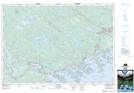
Maps showing Carryover Cove, Halifax, Nova Scotia
Carryover Cove is a Bay located in Halifax, Nova Scotia and has an elevation of 3 meters.
- Latitude: 44° 47' North (decimal: 44.7833333)
- Longitude: 62° 40' West (decimal: -62.6658333)
- Topography Feature Category: Bay
- Geographical Feature: Cove
- Canadian Province/Territory: Nova Scotia
- Elevation: 3 meters
- Location: Halifax
- Atlas of Canada Locator Map: Carryover Cove
- GPS Coordinate Locator Map: Carryover Cove Lat/Long