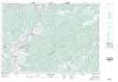
Maps showing Cooks Lake, Halifax, Nova Scotia
Cooks Lake is a Lake located in Halifax, Nova Scotia and has an elevation of 47 meters.
- Latitude: 45° 0' 20'' North (decimal: 45.0055555)
- Longitude: 63° 15' 50'' West (decimal: -63.2638888)
- Topography Feature Category: Lake
- Geographical Feature: Lake
- Canadian Province/Territory: Nova Scotia
- Elevation: 47 meters
- Location: Halifax
- Atlas of Canada Locator Map: Cooks Lake
- GPS Coordinate Locator Map: Cooks Lake Lat/Long