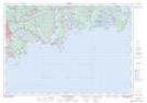
Maps showing Cow Bay, Halifax, Nova Scotia
Cow Bay is a Unincorporated area located in Halifax, Nova Scotia and has an elevation of 11 meters.
- Latitude: 44° 37' 10'' North (decimal: 44.6194444)
- Longitude: 63° 25' 22'' West (decimal: -63.4227777)
- Topography Feature Category: Unincorporated area
- Geographical Feature: Dispersed Rural Community
- Canadian Province/Territory: Nova Scotia
- Elevation: 11 meters
- Location: Halifax
- Atlas of Canada Locator Map: Cow Bay
- GPS Coordinate Locator Map: Cow Bay Lat/Long
Cow Bay NTS Map Sheets