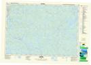
Maps showing Dargie Millpond, Annapolis, Nova Scotia
Dargie Millpond is a Lake located in Annapolis, Nova Scotia and has an elevation of 145 meters.
- Latitude: 44° 42' 16'' North (decimal: 44.7044444)
- Longitude: 65° 22' 32'' West (decimal: -65.3755555)
- Topography Feature Category: Lake
- Geographical Feature: Millpond / Mill Pond
- Canadian Province/Territory: Nova Scotia
- Elevation: 145 meters
- Location: Annapolis
- Atlas of Canada Locator Map: Dargie Millpond
- GPS Coordinate Locator Map: Dargie Millpond Lat/Long
Dargie Millpond NTS Map Sheets