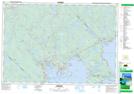
Maps showing Drain Lake, Lunenburg, Nova Scotia
Drain Lake is a Lake located in Lunenburg, Nova Scotia and has an elevation of 177 meters.
- Latitude: 44° 40' 37'' North (decimal: 44.6769444)
- Longitude: 64° 16' 34'' West (decimal: -64.2761111)
- Topography Feature Category: Lake
- Geographical Feature: Lake
- Canadian Province/Territory: Nova Scotia
- Elevation: 177 meters
- Location: Lunenburg
- Atlas of Canada Locator Map: Drain Lake
- GPS Coordinate Locator Map: Drain Lake Lat/Long
Drain Lake NTS Map Sheets