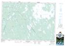
Maps showing Dr. Churchills Hole, Shelburne, Nova Scotia
Dr. Churchills Hole is a Lake located in Shelburne, Nova Scotia and has an elevation of 84 meters.
- Latitude: 44° 2' 35'' North (decimal: 44.0430555)
- Longitude: 65° 17' 9'' West (decimal: -65.2858333)
- Topography Feature Category: Lake
- Geographical Feature: Hole
- Canadian Province/Territory: Nova Scotia
- Elevation: 84 meters
- Location: Shelburne
- Atlas of Canada Locator Map: Dr. Churchills Hole
- GPS Coordinate Locator Map: Dr. Churchills Hole Lat/Long
Dr. Churchills Hole NTS Map Sheets