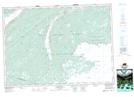
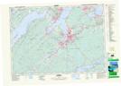
Maps showing East Bay Hills, Cape Breton, Nova Scotia
East Bay Hills is a Mountain located in Cape Breton, Nova Scotia and has an elevation of 38 meters.
- Latitude: 45° 55' North (decimal: 45.9166666)
- Longitude: 60° 30' West (decimal: -60.4991666)
- Topography Feature Category: Mountain
- Geographical Feature: Hills
- Canadian Province/Territory: Nova Scotia
- Elevation: 38 meters
- Location: Cape Breton
- Atlas of Canada Locator Map: East Bay Hills
- GPS Coordinate Locator Map: East Bay Hills Lat/Long
East Bay Hills NTS Map Sheets