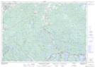
Maps showing Eastern Richardson Pond, Halifax, Nova Scotia
Eastern Richardson Pond is a Lake located in Halifax, Nova Scotia and has an elevation of 55 meters.
- Latitude: 44° 50' 4'' North (decimal: 44.8344444)
- Longitude: 63° 4' 58'' West (decimal: -63.0827777)
- Topography Feature Category: Lake
- Geographical Feature: Pond
- Canadian Province/Territory: Nova Scotia
- Elevation: 55 meters
- Location: Halifax
- Atlas of Canada Locator Map: Eastern Richardson Pond
- GPS Coordinate Locator Map: Eastern Richardson Pond Lat/Long
Eastern Richardson Pond NTS Map Sheets