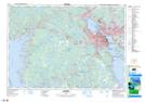
Maps showing East Pine Island Pond, Halifax, Nova Scotia
East Pine Island Pond is a Lake located in Halifax, Nova Scotia and has an elevation of 17 meters.
- Latitude: 44° 34' 59'' North (decimal: 44.5830555)
- Longitude: 63° 33' 35'' West (decimal: -63.5597222)
- Topography Feature Category: Lake
- Geographical Feature: Pond
- Canadian Province/Territory: Nova Scotia
- Elevation: 17 meters
- Location: Halifax
- Atlas of Canada Locator Map: East Pine Island Pond
- GPS Coordinate Locator Map: East Pine Island Pond Lat/Long