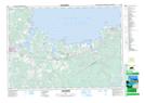
Maps showing East Tracadie, Antigonish, Nova Scotia
East Tracadie is a Unincorporated area located in Antigonish, Nova Scotia and has an elevation of 9 meters.
- Latitude: 45° 38' 29'' North (decimal: 45.6413888)
- Longitude: 61° 37' 26'' West (decimal: -61.6238888)
- Topography Feature Category: Unincorporated area
- Geographical Feature: Community
- Canadian Province/Territory: Nova Scotia
- Elevation: 9 meters
- Location: Antigonish
- Atlas of Canada Locator Map: East Tracadie
- GPS Coordinate Locator Map: East Tracadie Lat/Long