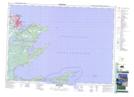
Maps showing Fergusons Pond, Cape Breton, Nova Scotia
Fergusons Pond is a Lake located in Cape Breton, Nova Scotia.
- Latitude: 46° 9' 26'' North (decimal: 46.1572222)
- Longitude: 59° 51' 35'' West (decimal: -59.8597222)
- Topography Feature Category: Lake
- Geographical Feature: Pond
- Canadian Province/Territory: Nova Scotia
- Location: Cape Breton
- Atlas of Canada Locator Map: Fergusons Pond
- GPS Coordinate Locator Map: Fergusons Pond Lat/Long
Fergusons Pond NTS Map Sheets
011J Map Not Available Topographic Map at 1:250,000 scale
