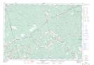
Maps showing Five Mile River, Hants, Nova Scotia
Five Mile River is a Unincorporated area located in Hants, Nova Scotia and has an elevation of 84 meters.
- Latitude: 45° 13' 23'' North (decimal: 45.2230555)
- Longitude: 63° 36' 25'' West (decimal: -63.6069444)
- Topography Feature Category: Unincorporated area
- Geographical Feature: Community
- Canadian Province/Territory: Nova Scotia
- Elevation: 84 meters
- Location: Hants
- Atlas of Canada Locator Map: Five Mile River
- GPS Coordinate Locator Map: Five Mile River Lat/Long