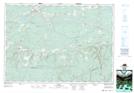
Maps showing Folly Lake Station, Colchester, Nova Scotia
Folly Lake Station is a Unincorporated area located in Colchester, Nova Scotia and has an elevation of 208 meters.
- Latitude: 45° 31' 24'' North (decimal: 45.5233333)
- Longitude: 63° 32' 54'' West (decimal: -63.5483333)
- Topography Feature Category: Unincorporated area
- Geographical Feature: Dispersed Rural Community
- Canadian Province/Territory: Nova Scotia
- Elevation: 208 meters
- Location: Colchester
- Atlas of Canada Locator Map: Folly Lake Station
- GPS Coordinate Locator Map: Folly Lake Station Lat/Long