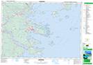
Maps showing Fort Point Pond, Lunenburg, Nova Scotia
Fort Point Pond is a Lake located in Lunenburg, Nova Scotia.
- Latitude: 44° 17' 16'' North (decimal: 44.2877777)
- Longitude: 64° 21' 11'' West (decimal: -64.3530555)
- Topography Feature Category: Lake
- Geographical Feature: Pond
- Canadian Province/Territory: Nova Scotia
- Location: Lunenburg
- Atlas of Canada Locator Map: Fort Point Pond
- GPS Coordinate Locator Map: Fort Point Pond Lat/Long
Fort Point Pond NTS Map Sheets