Maps showing Frying Pan Lake, Halifax, Nova Scotia
Frying Pan Lake is a Lake located in Halifax, Nova Scotia and has an elevation of 112 meters.
- Latitude: 44° 47' 32'' North (decimal: 44.7922222)
- Longitude: 63° 31' 21'' West (decimal: -63.5224999)
- Topography Feature Category: Lake
- Geographical Feature: Lake
- Canadian Province/Territory: Nova Scotia
- Elevation: 112 meters
- Location: Halifax
- Atlas of Canada Locator Map: Frying Pan Lake
- GPS Coordinate Locator Map: Frying Pan Lake Lat/Long
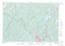
Frying Pan Lake NTS Map Sheets