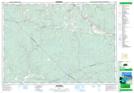
Maps showing Graham Hill, Colchester, Nova Scotia
Graham Hill is a Unincorporated area located in Colchester, Nova Scotia and has an elevation of 149 meters.
- Latitude: 45° 16' 57'' North (decimal: 45.2825000)
- Longitude: 62° 58' 59'' West (decimal: -62.9830555)
- Topography Feature Category: Unincorporated area
- Geographical Feature: Dispersed Rural Community
- Canadian Province/Territory: Nova Scotia
- Elevation: 149 meters
- Location: Colchester
- Atlas of Canada Locator Map: Graham Hill
- GPS Coordinate Locator Map: Graham Hill Lat/Long