Canada Topographic Maps

Hall Brook Topo Maps

Topography maps and Latitude/Longitude Location

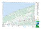
Maps showing Hall Brook, Nova Scotia

Hall Brook is a River located in Nova Scotia.

  • Latitude: 45° 12' North   (decimal: 45.2000000)
  • Longitude: 64° 37' West   (decimal: -64.6158333)
  • Topography Feature Category: River
  • Geographical Feature: Brook
  • Canadian Province/Territory: Nova Scotia
  • GPS Coordinate Locator Map: Hall Brook Lat/Long

Hall Brook NTS Map Sheets

021H02 Berwick Topographic Map at 1:50,000 scale

021H Amherst Topographic Map at 1:250,000 scale

 
Buy Topographic Maps DVD
Newsletter Sign-up

Yes, I want to receive map store discounts.


Bookmark and Share