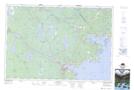
Maps showing Herring Cove Lake, Queens, Nova Scotia
Herring Cove Lake is a Lake located in Queens, Nova Scotia and has an elevation of 51 meters.
- Latitude: 44° 7' 26'' North (decimal: 44.1238888)
- Longitude: 64° 43' 5'' West (decimal: -64.7180555)
- Topography Feature Category: Lake
- Geographical Feature: Lake
- Canadian Province/Territory: Nova Scotia
- Elevation: 51 meters
- Location: Queens
- Atlas of Canada Locator Map: Herring Cove Lake
- GPS Coordinate Locator Map: Herring Cove Lake Lat/Long
Herring Cove Lake NTS Map Sheets