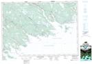
Maps showing Holland Harbour, Guysborough, Nova Scotia
Holland Harbour is a Unincorporated area located in Guysborough, Nova Scotia.
- Latitude: 45° 5' 34'' North (decimal: 45.0927777)
- Longitude: 61° 47' 45'' West (decimal: -61.7958333)
- Topography Feature Category: Unincorporated area
- Geographical Feature: Community
- Canadian Province/Territory: Nova Scotia
- Location: Guysborough
- Atlas of Canada Locator Map: Holland Harbour
- GPS Coordinate Locator Map: Holland Harbour Lat/Long
Holland Harbour NTS Map Sheets