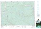
Maps showing Hoppenderry, Guysborough, Nova Scotia
Hoppenderry is a Unincorporated area located in Guysborough, Nova Scotia and has an elevation of 165 meters.
- Latitude: 45° 24' 52'' North (decimal: 45.4144444)
- Longitude: 61° 53' 17'' West (decimal: -61.8880555)
- Topography Feature Category: Unincorporated area
- Geographical Feature: Locality
- Canadian Province/Territory: Nova Scotia
- Elevation: 165 meters
- Location: Guysborough
- Atlas of Canada Locator Map: Hoppenderry
- GPS Coordinate Locator Map: Hoppenderry Lat/Long