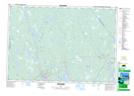
Maps showing Irvings Mill Run, Shelburne, Nova Scotia
Irvings Mill Run is a River located in Shelburne, Nova Scotia and has an elevation of 39 meters.
- Latitude: 43° 54' North (decimal: 43.9000000)
- Longitude: 65° 8' West (decimal: -65.1324999)
- Topography Feature Category: River
- Geographical Feature: Run
- Canadian Province/Territory: Nova Scotia
- Elevation: 39 meters
- Location: Shelburne
- Atlas of Canada Locator Map: Irvings Mill Run
- GPS Coordinate Locator Map: Irvings Mill Run Lat/Long
Irvings Mill Run NTS Map Sheets