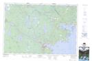
Maps showing Johns Millpond, Queens, Nova Scotia
Johns Millpond is a Lake located in Queens, Nova Scotia and has an elevation of 53 meters.
- Latitude: 44° 0' 11'' North (decimal: 44.0030555)
- Longitude: 64° 47' 14'' West (decimal: -64.7872222)
- Topography Feature Category: Lake
- Geographical Feature: Millpond / Mill Pond
- Canadian Province/Territory: Nova Scotia
- Elevation: 53 meters
- Location: Queens
- Atlas of Canada Locator Map: Johns Millpond
- GPS Coordinate Locator Map: Johns Millpond Lat/Long
Johns Millpond NTS Map Sheets