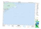
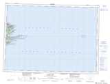
Maps showing Kennellys Pond, Cape Breton, Nova Scotia
Kennellys Pond is a Lake located in Cape Breton, Nova Scotia.
- Latitude: 45° 52' 49'' North (decimal: 45.8802777)
- Longitude: 59° 59' 35'' West (decimal: -59.9930555)
- Topography Feature Category: Lake
- Geographical Feature: Pond
- Canadian Province/Territory: Nova Scotia
- Location: Cape Breton
- Atlas of Canada Locator Map: Kennellys Pond
- GPS Coordinate Locator Map: Kennellys Pond Lat/Long
Kennellys Pond NTS Map Sheets