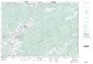
Maps showing Kent, Halifax, Nova Scotia
Kent is a Unincorporated area located in Halifax, Nova Scotia.
- Latitude: 45° 6' 13'' North (decimal: 45.1036111)
- Longitude: 63° 1' 26'' West (decimal: -63.0238888)
- Topography Feature Category: Unincorporated area
- Geographical Feature: Railway Point
- Canadian Province/Territory: Nova Scotia
- Location: Halifax
- Atlas of Canada Locator Map: Kent
- GPS Coordinate Locator Map: Kent Lat/Long