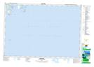
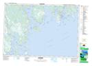
Maps showing Port La Tour, Shelburne, Nova Scotia
Port La Tour is a Bay located in Shelburne, Nova Scotia and has an elevation of 0 meters.
- Latitude: 43° 30' North (decimal: 43.4999999)
- Longitude: 65° 27' West (decimal: -65.4491666)
- Topography Feature Category: Bay
- Geographical Feature: Port
- Canadian Province/Territory: Nova Scotia
- Elevation: 0 meters
- Location: Shelburne
- Atlas of Canada Locator Map: Port La Tour
- GPS Coordinate Locator Map: Port La Tour Lat/Long
Port La Tour NTS Map Sheets