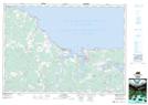
Maps showing Lewis Reef, Cumberland, Nova Scotia
Lewis Reef is a Shoal located in Cumberland, Nova Scotia.
- Latitude: 45° 53' North (decimal: 45.8833333)
- Longitude: 63° 44' West (decimal: -63.7325000)
- Topography Feature Category: Shoal
- Geographical Feature: Reef
- Canadian Province/Territory: Nova Scotia
- Location: Cumberland
- Atlas of Canada Locator Map: Lewis Reef
- GPS Coordinate Locator Map: Lewis Reef Lat/Long