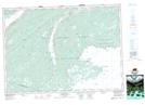
Maps showing Lily Pond, Cape Breton, Nova Scotia
Lily Pond is a Lake located in Cape Breton, Nova Scotia.
- Latitude: 45° 49' 29'' North (decimal: 45.8247222)
- Longitude: 60° 13' 52'' West (decimal: -60.2311111)
- Topography Feature Category: Lake
- Geographical Feature: Pond
- Canadian Province/Territory: Nova Scotia
- Location: Cape Breton
- Atlas of Canada Locator Map: Lily Pond
- GPS Coordinate Locator Map: Lily Pond Lat/Long