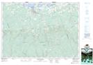
Maps showing Lily Ponds, Colchester, Nova Scotia
Lily Ponds is a Lake located in Colchester, Nova Scotia and has an elevation of 278 meters.
- Latitude: 45° 33' 0'' North (decimal: 45.5500000)
- Longitude: 63° 29' 24'' West (decimal: -63.4900000)
- Topography Feature Category: Lake
- Geographical Feature: Ponds
- Canadian Province/Territory: Nova Scotia
- Elevation: 278 meters
- Location: Colchester
- Atlas of Canada Locator Map: Lily Ponds
- GPS Coordinate Locator Map: Lily Ponds Lat/Long