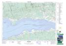
Maps showing Little Bass River, Colchester, Nova Scotia
Little Bass River is a Unincorporated area located in Colchester, Nova Scotia and has an elevation of 10 meters.
- Latitude: 45° 23' 58'' North (decimal: 45.3994444)
- Longitude: 63° 48' 27'' West (decimal: -63.8074999)
- Topography Feature Category: Unincorporated area
- Geographical Feature: Dispersed Rural Community
- Canadian Province/Territory: Nova Scotia
- Elevation: 10 meters
- Location: Colchester
- Atlas of Canada Locator Map: Little Bass River
- GPS Coordinate Locator Map: Little Bass River Lat/Long