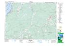
Maps showing Little Forks, Cumberland, Nova Scotia
Little Forks is a Unincorporated area located in Cumberland, Nova Scotia and has an elevation of 44 meters.
- Latitude: 45° 42' 21'' North (decimal: 45.7058333)
- Longitude: 64° 8' 59'' West (decimal: -64.1497222)
- Topography Feature Category: Unincorporated area
- Geographical Feature: Community
- Canadian Province/Territory: Nova Scotia
- Elevation: 44 meters
- Location: Cumberland
- Atlas of Canada Locator Map: Little Forks
- GPS Coordinate Locator Map: Little Forks Lat/Long