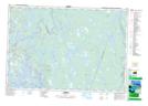
Maps showing Lower Eel Brook, Yarmouth, Nova Scotia
Lower Eel Brook is a Unincorporated area located in Yarmouth, Nova Scotia and has an elevation of 0 meters.
- Latitude: 43° 49' 2'' North (decimal: 43.8172222)
- Longitude: 65° 54' 26'' West (decimal: -65.9072222)
- Topography Feature Category: Unincorporated area
- Geographical Feature: Locality
- Canadian Province/Territory: Nova Scotia
- Elevation: 0 meters
- Location: Yarmouth
- Atlas of Canada Locator Map: Lower Eel Brook
- GPS Coordinate Locator Map: Lower Eel Brook Lat/Long