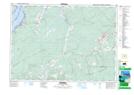
Maps showing Lower River Hébert, Nova Scotia
Lower River Hébert is a Unincorporated area located in Nova Scotia and has an elevation of 13 meters.
- Latitude: 45° 43' 12'' North (decimal: 45.7200000)
- Longitude: 64° 21' 19'' West (decimal: -64.3552777)
- Topography Feature Category: Unincorporated area
- Geographical Feature: Locality
- Canadian Province/Territory: Nova Scotia
- Elevation: 13 meters
- Atlas of Canada Locator Map: Lower River Hébert
- GPS Coordinate Locator Map: Lower River Hébert Lat/Long