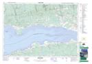
Maps showing Lower Selmah, Nova Scotia
Lower Selmah is a Unincorporated area located in Nova Scotia.
- Latitude: 45° 19' North (decimal: 45.3166666)
- Longitude: 63° 36' West (decimal: -63.5991666)
- Topography Feature Category: Unincorporated area
- Geographical Feature: Settlement
- Canadian Province/Territory: Nova Scotia
- GPS Coordinate Locator Map: Lower Selmah Lat/Long