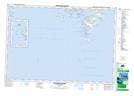
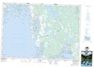
Maps showing Lower Shag Harbour, Shelburne, Nova Scotia
Lower Shag Harbour is a Bay located in Shelburne, Nova Scotia and has an elevation of 1 meters.
- Latitude: 43° 30' North (decimal: 43.4999998)
- Longitude: 65° 41' West (decimal: -65.6825)
- Topography Feature Category: Bay
- Geographical Feature: Harbour
- Canadian Province/Territory: Nova Scotia
- Elevation: 1 meters
- Location: Shelburne
- Atlas of Canada Locator Map: Lower Shag Harbour
- GPS Coordinate Locator Map: Lower Shag Harbour Lat/Long
Lower Shag Harbour NTS Map Sheets