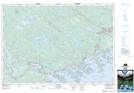
Maps showing Lower Ship Harbour East, Nova Scotia
Lower Ship Harbour East is a Unincorporated area located in Nova Scotia.
- Latitude: 44° 47' North (decimal: 44.7833333)
- Longitude: 62° 48' West (decimal: -62.7991666)
- Topography Feature Category: Unincorporated area
- Geographical Feature: Dispersed Rural Community
- Canadian Province/Territory: Nova Scotia
- GPS Coordinate Locator Map: Lower Ship Harbour East Lat/Long