Canada Topographic Maps

McDougall Pond Topo Maps

Topography maps and Latitude/Longitude Location

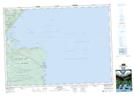
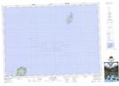
Maps showing McDougall Pond, Nova Scotia

McDougall Pond is a Lake located in Nova Scotia.

  • Latitude: 47° 00' North   (decimal: 46.9999999)
  • Longitude: 60° 28' West   (decimal: -60.4658333)
  • Topography Feature Category: Lake
  • Geographical Feature: Pond
  • Canadian Province/Territory: Nova Scotia
  • GPS Coordinate Locator Map: McDougall Pond Lat/Long

McDougall Pond NTS Map Sheets

011K16 Dingwall Topographic Map at 1:50,000 scale

011N01 Cape North Topographic Map at 1:50,000 scale

011K Sydney Topographic Map at 1:250,000 scale

011N Iles De La Madeleine Topographic Map at 1:250,000 scale

 
Buy Topographic Maps DVD
Newsletter Sign-up

Yes, I want to receive map store discounts.


Bookmark and Share