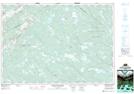
Maps showing Miller Meadows, Halifax, Nova Scotia
Miller Meadows is a Low vegetation located in Halifax, Nova Scotia and has an elevation of 136 meters.
- Latitude: 45° 1' North (decimal: 45.0166666)
- Longitude: 62° 56' West (decimal: -62.9324999)
- Topography Feature Category: Low vegetation
- Geographical Feature: Meadows
- Canadian Province/Territory: Nova Scotia
- Elevation: 136 meters
- Location: Halifax
- Atlas of Canada Locator Map: Miller Meadows
- GPS Coordinate Locator Map: Miller Meadows Lat/Long
Miller Meadows NTS Map Sheets