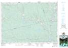
Maps showing Mill Pond, Guysborough, Nova Scotia
Mill Pond is a Lake located in Guysborough, Nova Scotia.
- Latitude: 45° 15' 23'' North (decimal: 45.2563888)
- Longitude: 62° 7' 18'' West (decimal: -62.1216666)
- Topography Feature Category: Lake
- Geographical Feature: Millpond / Mill Pond
- Canadian Province/Territory: Nova Scotia
- Location: Guysborough
- Atlas of Canada Locator Map: Mill Pond
- GPS Coordinate Locator Map: Mill Pond Lat/Long