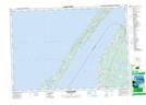
Maps showing Moore Ledge, Nova Scotia
Moore Ledge is a Shoal located in Nova Scotia.
- Latitude: 44° 20' North (decimal: 44.3333333)
- Longitude: 66° 21' West (decimal: -66.3491666)
- Topography Feature Category: Shoal
- Geographical Feature: Ledge
- Canadian Province/Territory: Nova Scotia
- GPS Coordinate Locator Map: Moore Ledge Lat/Long
Moore Ledge NTS Map Sheets