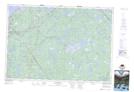
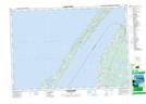
Maps showing Ohio, Digby, Nova Scotia
Ohio is a Unincorporated area located in Digby, Nova Scotia and has an elevation of 35 meters.
- Latitude: 44° 23' 26'' North (decimal: 44.3905555)
- Longitude: 66° 0' 26'' West (decimal: -66.0072221)
- Topography Feature Category: Unincorporated area
- Geographical Feature: Community
- Canadian Province/Territory: Nova Scotia
- Elevation: 35 meters
- Location: Digby
- Atlas of Canada Locator Map: Ohio
- GPS Coordinate Locator Map: Ohio Lat/Long
Ohio NTS Map Sheets