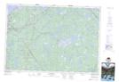
Maps showing Paul Lake, Digby, Nova Scotia
Paul Lake is a Lake located in Digby, Nova Scotia and has an elevation of 90 meters.
- Latitude: 44° 17' 42'' North (decimal: 44.2950000)
- Longitude: 65° 53' 6'' West (decimal: -65.8849999)
- Topography Feature Category: Lake
- Geographical Feature: Lake
- Canadian Province/Territory: Nova Scotia
- Elevation: 90 meters
- Location: Digby
- Atlas of Canada Locator Map: Paul Lake
- GPS Coordinate Locator Map: Paul Lake Lat/Long
Paul Lake NTS Map Sheets