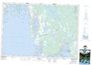
Maps showing The Peak, Yarmouth, Nova Scotia
The Peak is a Shoal located in Yarmouth, Nova Scotia.
- Latitude: 43° 36' North (decimal: 43.6000000)
- Longitude: 65° 50' West (decimal: -65.8324999)
- Topography Feature Category: Shoal
- Geographical Feature: Shoal
- Canadian Province/Territory: Nova Scotia
- Location: Yarmouth
- Atlas of Canada Locator Map: The Peak
- GPS Coordinate Locator Map: The Peak Lat/Long