Canada Topographic Maps

Perry Shoal Topo Maps

Topography maps and Latitude/Longitude Location

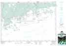
Maps showing Perry Shoal, Nova Scotia

Perry Shoal is a Shoal located in Nova Scotia.

  • Latitude: 44° 50' North   (decimal: 44.8333333)
  • Longitude: 62° 27' West   (decimal: -62.4491666)
  • Topography Feature Category: Shoal
  • Geographical Feature: Shoal
  • Canadian Province/Territory: Nova Scotia
  • GPS Coordinate Locator Map: Perry Shoal Lat/Long

Perry Shoal NTS Map Sheets

011D16 Ecum Secum Topographic Map at 1:50,000 scale

011D Halifax Topographic Map at 1:250,000 scale

 
Buy Topographic Maps DVD
Newsletter Sign-up

Yes, I want to receive map store discounts.


Bookmark and Share