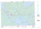
Maps showing Port Hastings, Inverness, Nova Scotia
Port Hastings is a Unincorporated area located in Inverness, Nova Scotia and has an elevation of 18 meters.
- Latitude: 45° 38' 46'' North (decimal: 45.6461111)
- Longitude: 61° 24' 11'' West (decimal: -61.4030555)
- Topography Feature Category: Unincorporated area
- Geographical Feature: Community
- Canadian Province/Territory: Nova Scotia
- Elevation: 18 meters
- Location: Inverness
- Atlas of Canada Locator Map: Port Hastings
- GPS Coordinate Locator Map: Port Hastings Lat/Long
Port Hastings NTS Map Sheets