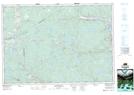
Maps showing Punchs Pond, Guysborough, Nova Scotia
Punchs Pond is a Lake located in Guysborough, Nova Scotia and has an elevation of 123 meters.
- Latitude: 45° 24' 27'' North (decimal: 45.4074999)
- Longitude: 61° 47' 34'' West (decimal: -61.7927777)
- Topography Feature Category: Lake
- Geographical Feature: Pond
- Canadian Province/Territory: Nova Scotia
- Elevation: 123 meters
- Location: Guysborough
- Atlas of Canada Locator Map: Punchs Pond
- GPS Coordinate Locator Map: Punchs Pond Lat/Long