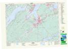
Maps showing Rear of Ball Creek, Nova Scotia
Rear of Ball Creek is a Unincorporated area located in Nova Scotia.
- Latitude: 46° 8' North (decimal: 46.1333333)
- Longitude: 60° 20' West (decimal: -60.3324999)
- Topography Feature Category: Unincorporated area
- Geographical Feature: Dispersed Rural Community
- Canadian Province/Territory: Nova Scotia
- GPS Coordinate Locator Map: Rear of Ball Creek Lat/Long