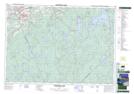
Maps showing Rockville Notch, Kings, Nova Scotia
Rockville Notch is a Unincorporated area located in Kings, Nova Scotia and has an elevation of 83 meters.
- Latitude: 44° 57' 2'' North (decimal: 44.9505555)
- Longitude: 64° 53' 28'' West (decimal: -64.8911111)
- Topography Feature Category: Unincorporated area
- Geographical Feature: Dispersed Rural Community
- Canadian Province/Territory: Nova Scotia
- Elevation: 83 meters
- Location: Kings
- Atlas of Canada Locator Map: Rockville Notch
- GPS Coordinate Locator Map: Rockville Notch Lat/Long
Rockville Notch NTS Map Sheets