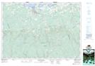
Maps showing Rorys Pond, Colchester, Nova Scotia
Rorys Pond is a Lake located in Colchester, Nova Scotia and has an elevation of 307 meters.
- Latitude: 45° 33' 37'' North (decimal: 45.5602777)
- Longitude: 63° 27' 45'' West (decimal: -63.4624999)
- Topography Feature Category: Lake
- Geographical Feature: Pond
- Canadian Province/Territory: Nova Scotia
- Elevation: 307 meters
- Location: Colchester
- Atlas of Canada Locator Map: Rorys Pond
- GPS Coordinate Locator Map: Rorys Pond Lat/Long